


Garmin BlueChart g3 Vision - SD Card - Africa, Knysna, SA to Beira, MZ Coastal and Inland Charts
Garmin BlueChart g3 Vision - SD Card - Africa, Knysna, SA to Beira, MZ Coastal and Inland Charts
SKU:SP-GA-010C075200
En existencias
**Disclaimer**
Some Garmin product are not kept in stock at all times and may take an additional 3-4 days to order straight from Garmin. We are able to get all Garmin products listed on the website.
No se pudo cargar la disponibilidad de retiro
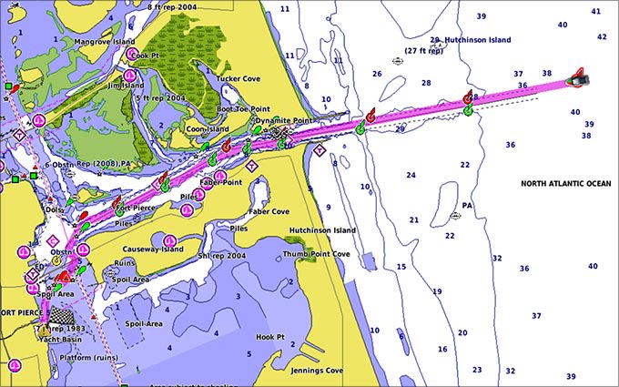
Garmin's Premium Chart Offering
Auto Guidance
Auto Guidance technology quickly calculates a suggested route using your boat's dimensions and a suggested path to follow.
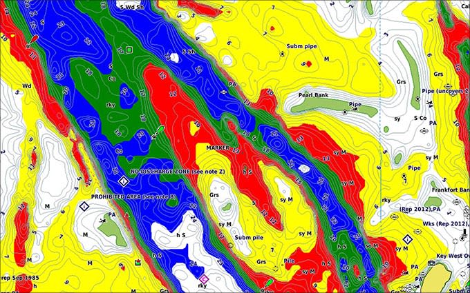
Depth Range Shading
Displays high-resolution Depth Range Shading for up to 10 depth ranges so you can view your designated target depth.
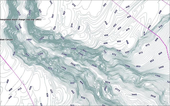
Detailed Contours
BlueChart g3 Vision HD features 1-foot contours that provide a more accurate depiction of bottom structure for improved fishing charts and enhanced detail in swamps, canals and port plans.
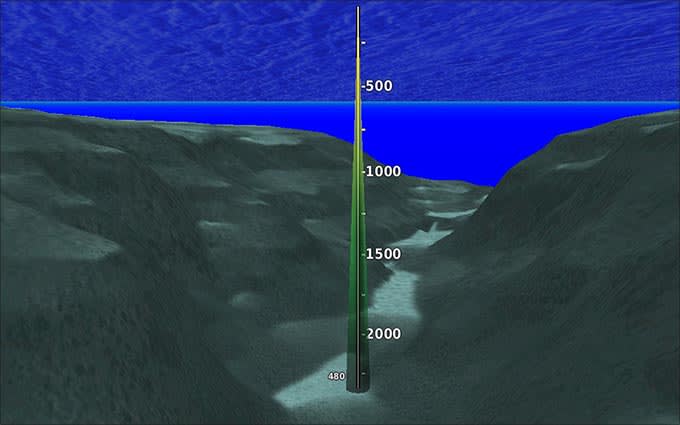
MarinerEye View
Provides a 3-D representation of the ocean floor as seen from below the waterline.
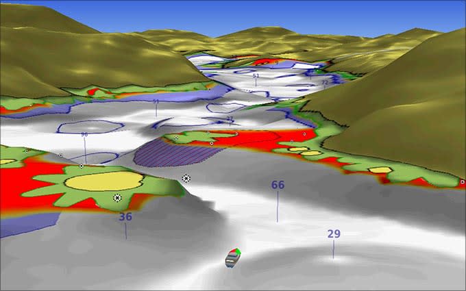
FishEye View
Provides a 3-D representation of the surrounding area both above and below the waterline.
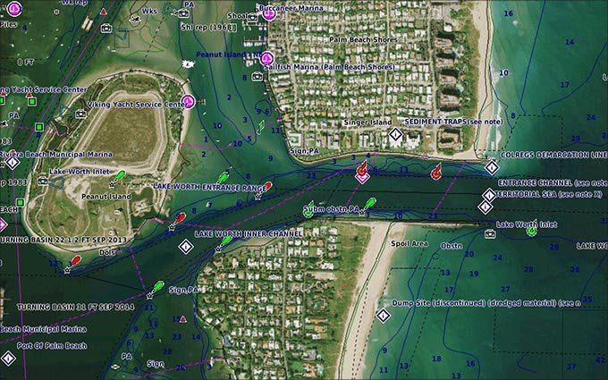
High-resolution Satellite Imagery
High-resolution satellite imagery with navigational charts overlaid gives you a realistic view of your surroundings so you can navigate with a clear moving-chart representation of your boat’s position. It’s our most realistic charting display in a chartplotter.
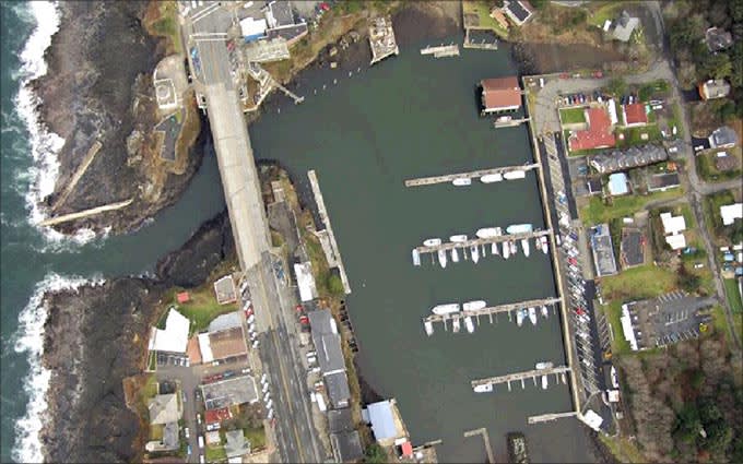
Aerial Photography
Crystal clear aerial photography shows exceptional detail of many ports, harbours and marinas and is ideal when entering unfamiliar ports.
*Disclaimer
This product is non-refundable due to the Chart/Map being in a downloadable Format.
Shipping & Returns
Shipping & Returns
There is a 2-day order processing time, all deliveries will be made within 3 - 5 working days.
At the checkout, please select your delivery region in order to facilitate smooth delivery.
Returns need to made within 14 days in order for us to arrange a refund or swap out of product. The product needs to be retuned in the same condition as received. There will be a 10% handling fee for any damaged packaging.
Gamin downloadable products and a few select products are not refundable.


